
Ward 1
December 1, 2022
Ward 1 includes the following schools:
- Brock Corydon (N-6)
- Grant Park (7-12)
- Harrow (N-6)
- J.B. Mitchell (N-6)
- Montrose (N-6)
- Rockwood (N-6)
- Sir William Osler (N-6)
Click on the image for a larger pdf version of the map: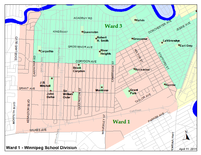
Boundary Description:
From South Division boundary (Wilkes Ave), north on extension of Morpeth Blvd, north along Morpeth Blvd, continue north along Edgeland Blvd to Assiniboine River, east along Assiniboine River to Kenaston Blvd, south along Kenaston Blvd to Corydon Ave, east along Corydon Ave to Cambridge St, north along Cambridge St to Dorchester Ave, east along Dorchester Ave to Stafford St, south along Stafford St to Pembina Hwy, south along Pembina Hwy to South Division boundary (south side of Parker Ave), west along extension of Parker Ave (south side) to Heatherdale Ave, west following the North Perimeter Line of the properties on the North Side of Parker Avenue between Wynne Street and Hurst Way, south along Hurst Way to south side of Parker Ave, continue west along extension of Parker Ave to Waverley St, north along Waverley St to Wilkes Ave, west along Wilkes Ave to extension of Morpeth Blvd (Division boundary).